HTML Preview Water Balance page number 1.
DEPARTMENT OF THE ARMY
ENGINEER RESEARCH AND DEVELOPMENT CENTER, CORPS OF ENGINEERS
ENVIRONMENTAL LABORATORY
WATERWAYS EXPERIMENT STATION, 3909 HALLS FERRY ROAD
VICKSBURG, MISSISSIPPI 39180-6199
24 February 2006
Printed on Recycled Paper
CEERD-EP-E
MEMORANDUM FOR: U.S. Army Engineer District, Detroit, ATTN: CELRE-PL-E (L. Weigum)
SUBJECT: Leachate Seepage and Surface Runoff from the Grassy Island, Wayne County, MI
1. This memorandum was prepared for CELRE in response to a request for assistance under
the Dredging Operations Technical Support (DOTS) program, DOTS request 2006-001. The
objectives were to estimate annual average drainage to the overflow weir due to runoff and
annual average seepage through the dike walls. A water balance model, the U.S.
Environmental Protection Agency’s (USEPA) Hydrologic Evaluation of Landfill Performance
(HELP) model (Schroeder et al. 1994a, Schroeder et al. 1994b), was used. Studies cited by
Millsap (2004) were reviewed for water table elevations and other hydrologic data for input to
the model.
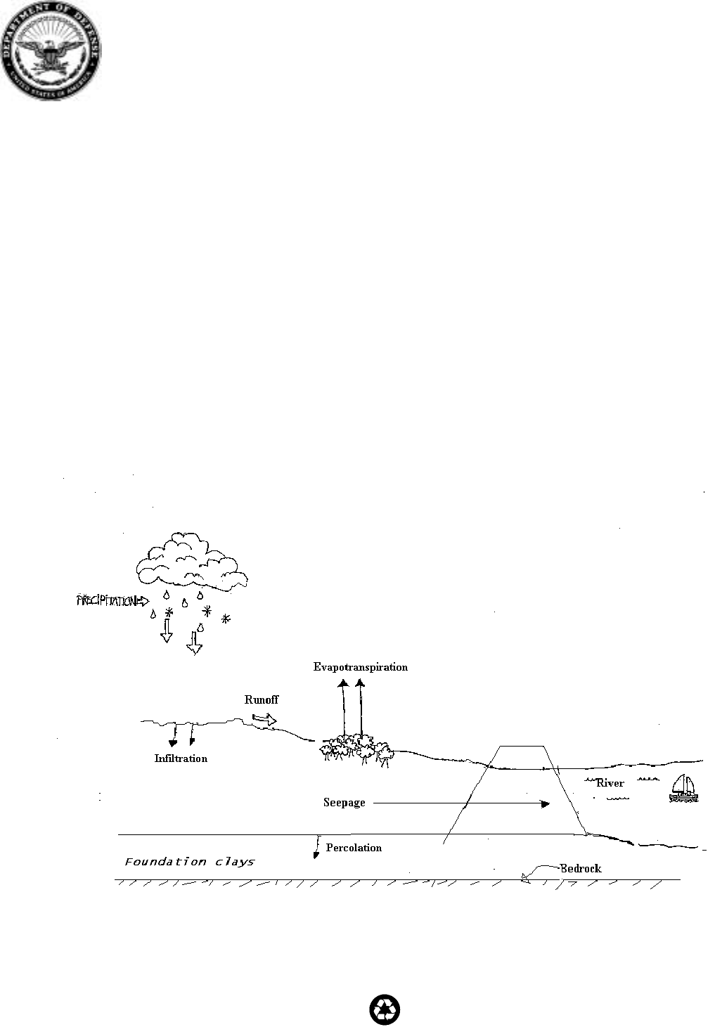
2. The water balance of a place, whether it be an agricultural field, watershed, or continent, can
be determined by calculating the input, output, and storage changes of water at the ground
surface. Figure 1 below is a definition sketch for the water balance at Grassy Island.
Figure 1. Water Balance Sketch for Grassy Island, MI.
REPLY TO
ATTENTION OF